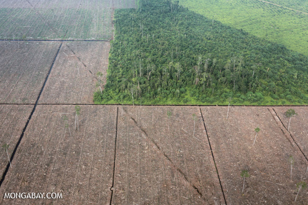
If you were living through the haze which affected millions across Malaysia, Singapore and Indonesia last year, then you know that much of it had to do with slash-and-burn tactics by errant farmers and individuals on unsupervised farm concessions under the jurisdiction of major palm oil and paper companies.
If you thought last year was bad, this first quarter of forest disturbance makes it look like governments, companies and subsistence farmers care as much as a honey badger, which is not much at all.
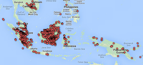
According to Mongabay.com, an independent nature and wildlife news website, NASA’s Quarterly Indicator of Cover Change (QUICC), a satellite-based product that supports Mongabay.com’s Global Forest Disturbance Alert System (GloF-DAS), recorded numbers, which have more than doubled, of deforestation signals in Bolivia (162 per cent increase), Malaysia (150 per cent), Panama (123 per cent), and Ecuador (115 per cent) relative to a five-year baseline.
The GloF-DAS was developed by NASA Ames Research Center, Cal State Monterey Bay and Mongabay.com.
According to a senior research scientist at NASA Ames Research Center, most of Malaysia’s forest disturbances are occurring in the states of Pahang and Negeri Sembilan.
In a Monganbay.com report last year, Googles new global forest map revealed that Malaysia had the world’s highest rate of forest loss between 2000 and 2012.
More commitment’s needed from governments and companies. Obvs!
